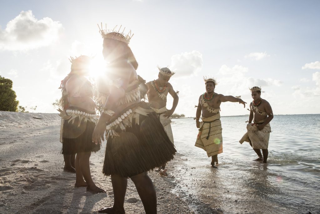
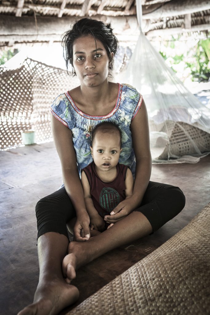
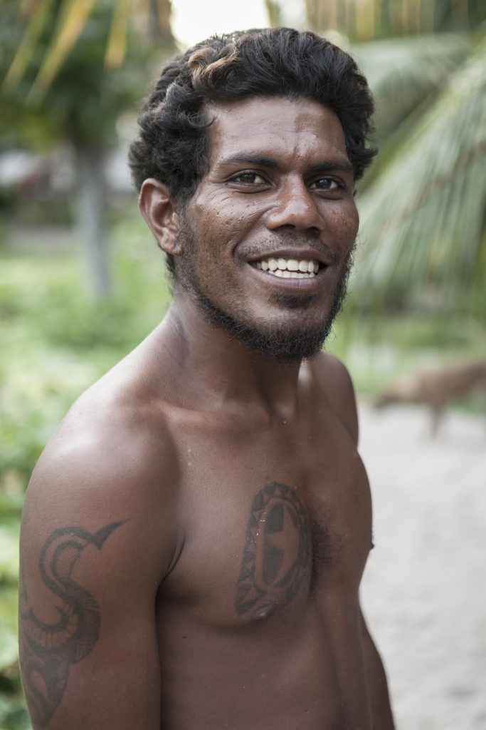
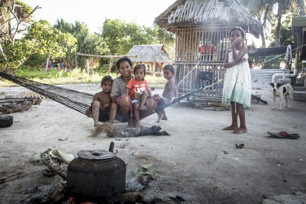
Im Sommer 2018 reiste die Fotografin Barbara Dombrowski auf die südpazifischen Inseln Kiribati und Rarotonga. Die Reise war sowohl der Abschluss ihres Fotozyklus „Tropic Ice_Dialog zwischen vom Klimawandel betroffenen Orten“ als auch der Ausgangspunkt für einen Zyklus spektakulärer Installationen, die auf den Klimawandel und seine Folgen für Kultur und Ureinwohner auf fünf Kontinenten aufmerksam machen sollen.

Die Bilder des kiribatischen Archipels stehen in engem Zusammenhang mit den Forschungen der Kieler Geographin Silja Klepp. Die Professorin für Soziale Dynamik in Küsten- und Meeresregionen an der Universität Kiel hat dort mehrere längere Forschungsaufenthalte verbracht, bei denen sie sich mit den sozialen und kulturellen Folgen des Klimawandels beschäftigte und Fragen der Klimamigration und -anpassung untersuchte.
Die Bilder des kiribatischen Archipels sind eng mit der Forschung der Kieler Geografin Silja Klepp verknüpft.
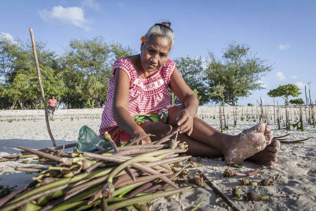
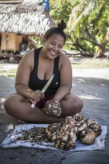
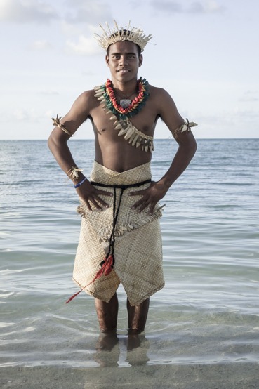
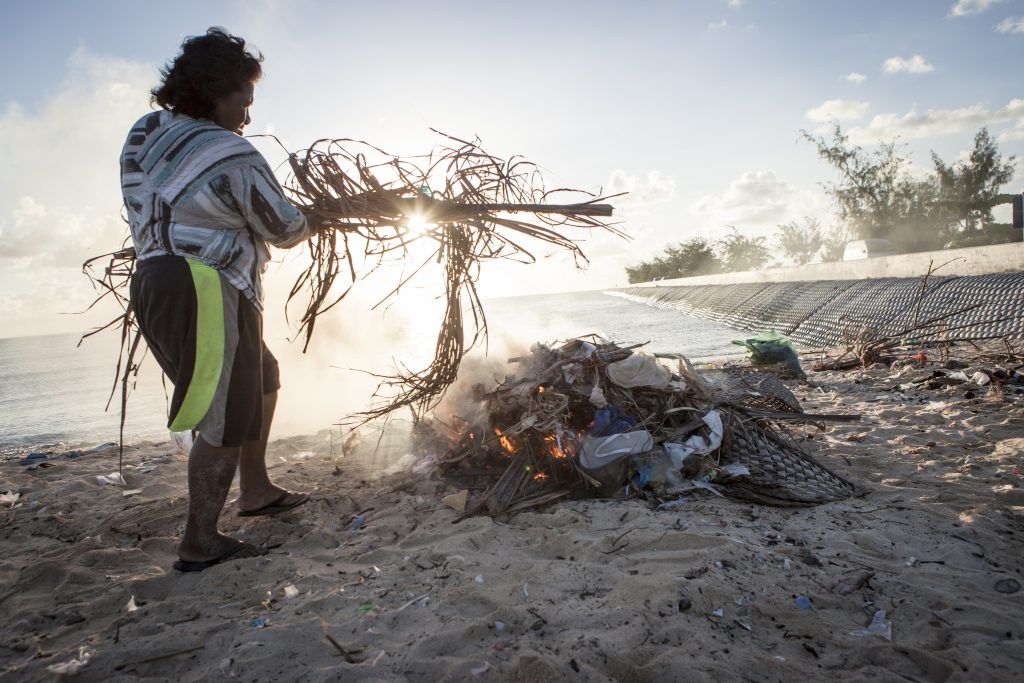
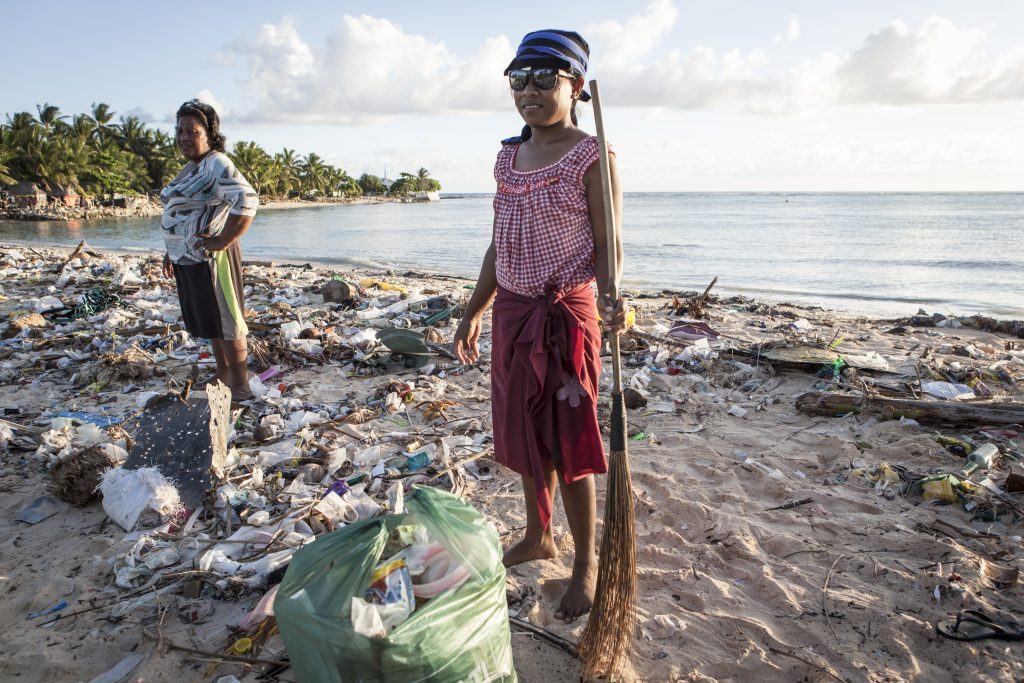
Die Ausstellung zeigt einen Auszug aus der Dokumentation von Barbara Dombrowskis Reise und Silja Klepps persönliche Kontakte und Forschungsorte. Die Ausstellung dokumentiert, wie die Menschen auf den südpazifischen Inseln vom Klimawandel betroffen sind, welche Anpassungsmaßnahmen sie ergriffen haben und welche Strategien sie verfolgen, um Migration zu vermeiden und zu Flüchtlingen zu werden. Neben den Fotoinstallationen veranschaulichen die Texte von Silja Klepp die Herausforderungen, denen sich die mit dem Klimawandel lebende Bevölkerung gegenübersieht und zu deren Folgen, wie zum Beispiel dem Anstieg des Meeresspiegels, sie am wenigsten beigetragen hat.
Die Ausstellung „Klimagerechtigkeit in Kiribati“ ist Teil des interdisziplinären Workshops „Narratives and practices of environmental justice“ an der Universität Kiel, der rund 60 internationale Wissenschaftler zusammenführt, um grundlegende Fragen der Umweltgerechtigkeit aus verschiedenen wissenschaftlichen Perspektiven zu diskutieren. Der Workshop wird von Silja Klepp, Florian Dünckmann und Jonas Hein vom Geographischen Institut organisiert.
Gleichzeitig ist die Veranstaltung der Startschuss für das neue „Enjust Network for Environmental Justice“ an der Universität Kiel, das künftig eine Schnittstelle zwischen Wissenschaft, Politik und Gesellschaft bilden wird. Darüber hinaus werden Wissenschaftlerinnen und Wissenschaftler des Geographischen Instituts, des Fachbereichs Philosophie, des Fachbereichs Umweltethik, des Fachbereichs Rechtswissenschaft, des Fachbereichs Sinologie und des Fachbereichs Politik- und Sozialwissenschaften an dem Projekt mitwirken und ein breites interdisziplinäres Forschungsumfeld für das Themenfeld bilden. Die Ausstellung soll dazu beitragen, verschiedene Menschen miteinander in Dialog zu bringen, um sich über Fragen der Klimagerechtigkeit auszutauschen.
Klimagerechtigkeit in Kiribati, Ozeanien
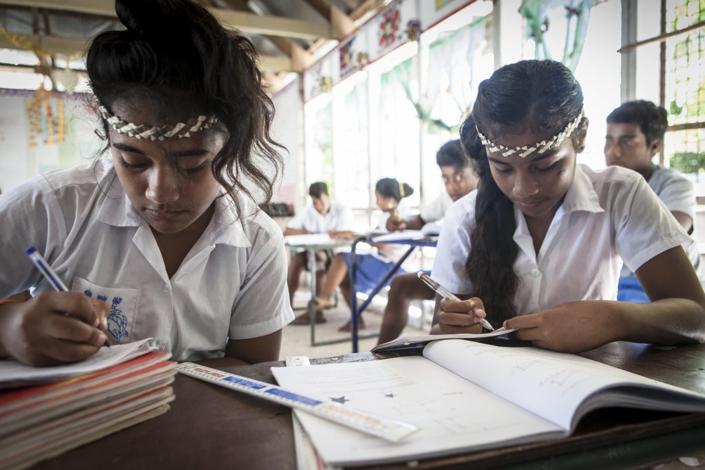
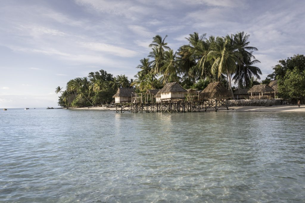
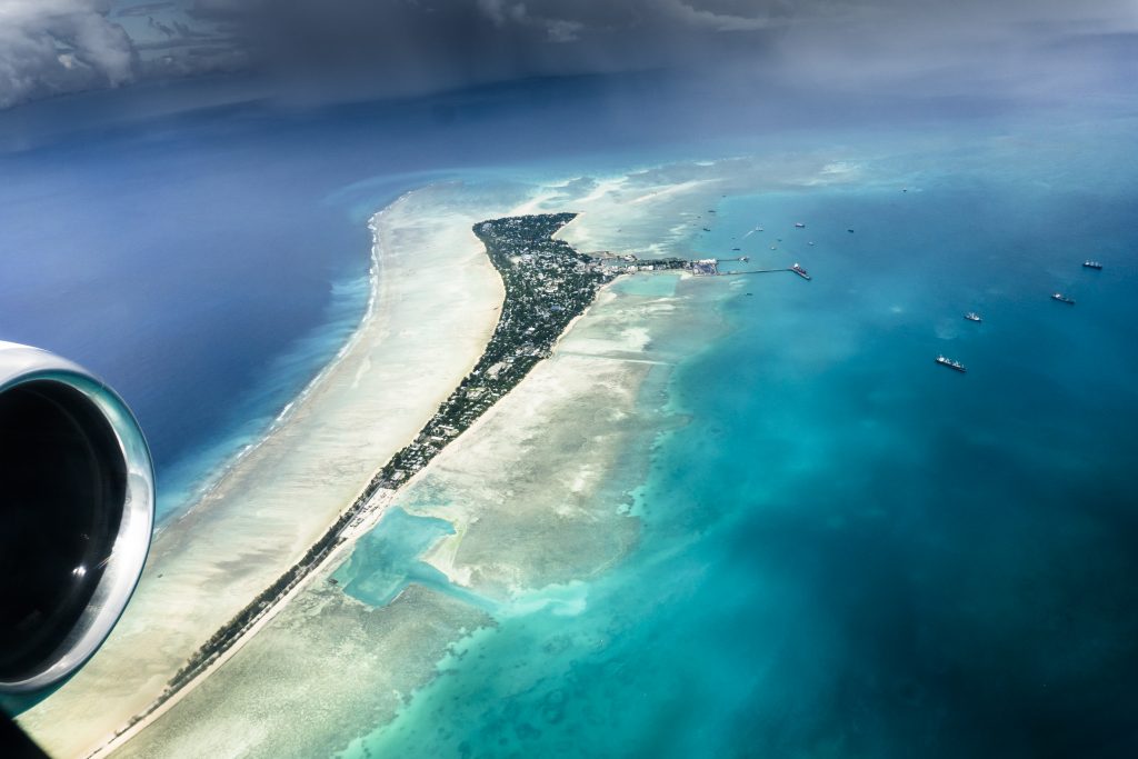
Die Republik Kiribati ist ein Inselstaat im zentralen Pazifik, der aus 32 Atollen besteht und rund 110.000 Einwohner hat. Ungleichheiten auf verschiedenen Ebenen im Zusammenhang mit dem globalen Klimawandel wirken sich nachteilig auf Entwicklungsländer wie die Republik Kiribati aus. Die Einwohner Kiribatis tragen wenig Verantwortung für den anthropogenen Klimawandel, da ihre Pro-Kopf-Emissionen gering sind; dennoch sind sie stark von tatsächlichen und erwarteten Umweltveränderungen betroffen. Das Konfliktpotential der Klimagerechtigkeitsdebatten zeigt sich besonders deutlich in den Diskursen über die Zusammenhänge zwischen Klimawandel und Mobilität. Länder wie Kiribati werden oft als die ersten Opfer des Klimawandels wahrgenommen und müssen mit der zukünftigen Unbewohnbarkeit ihres Territoriums rechnen. Solche Länder beanspruchen globale und regionale Solidarität, um sie bei der Suche nach Minderungsbemühungen, Anpassungsfinanzierung und angemessenen langfristigen Lösungen für potenzielle Klimamigranten zu unterstützen.
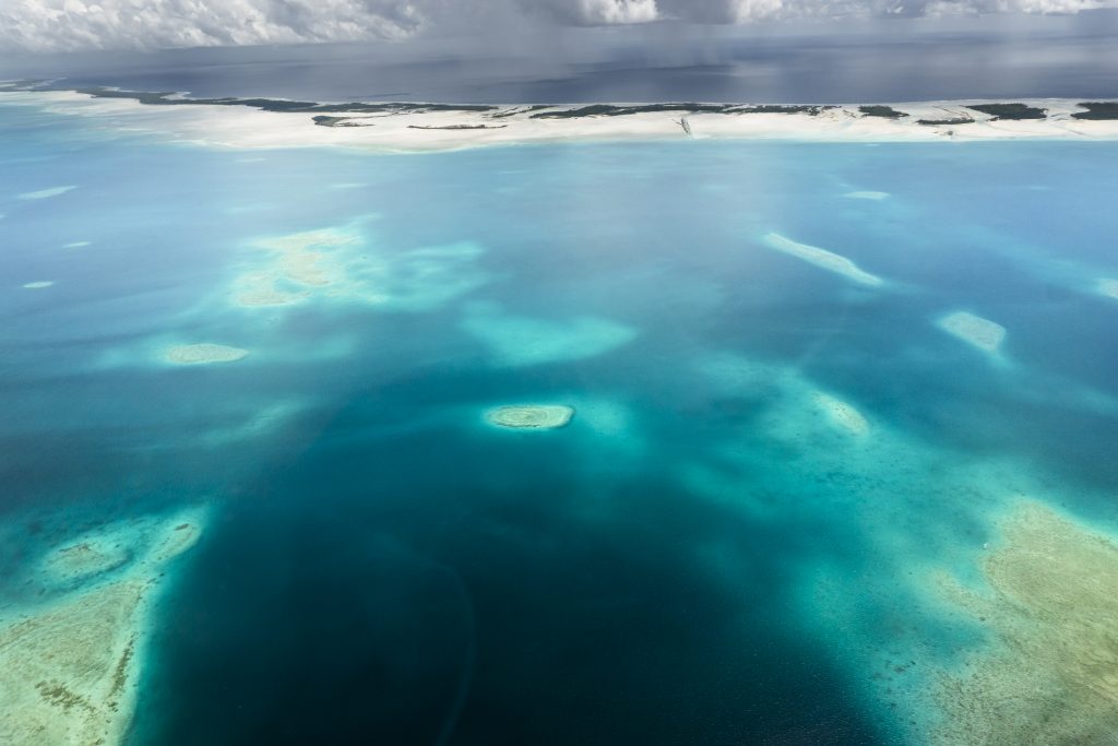
Einige Umweltveränderungen finden bereits statt, wie z.B. stärkere und häufigere Sturmfluten, Küstenerosion und die Versalzung von Süßwasserquellen und landwirtschaftlichen Flächen. Obwohl der vorhergesagte Anstieg des Meeresspiegels globale, regionale und lokale Variablen berücksichtigen muss, die diese Vorhersagen erschweren, werden pazifische Inselstaaten wie die Republik Kiribati, Tuvalu und die Marshall-Inseln als besonders gefährdet eingestuft. Einige dieser Inseln liegen weniger als einen Meter über dem Meeresspiegel und haben dicht besiedelte Küstengebiete. Es wird erwartet, dass der Meeresspiegel bis zum Jahr 2100 um 124 cm ansteigt, und einige Forscher sagen sogar einen Anstieg um 200 cm voraus. Umweltveränderungen könnten die Inseln auf lange Sicht unbewohnbar machen und die Souveränität einiger Atollstaaten bedrohen. Der Zeitpunkt und die Vorhersagen bezüglich der genauen Auswirkungen bleiben ungewiss.
Along with profound socio-economic problems and few opportunities for financing adaptation measures, Kiribati suffers from additional structural inequalities on various levels. These include for example, the impacts of colonization, including unsustainable phosphor exploitation, which displaced people in the 1940s as well as limited access to resources and social services. The participation and arrangement opportunities in international as well as regional political negotiations are also restricted.
On the global and regional level, the government of Kiribati is part of the large transnational movement for climate justice, which focuses on human rights and the cultural and environmental rights of indigenous peoples and minorities. The activities of this movement are often initiated by NGOs. For example, the network Climate Justice Now! was created in the frame of the UNFCCC negotiations in 2007 in Bali by more than 30 NGOs and grassroots organizations. The Peoples Agreement, created at the Peoples congress 2010 in Bolivia, demands far reaching rights of self-determination such as access to water, land rights and food production “through forms of production that are in harmony with Mother Earth and appropriate to local cultural ontextsâ€.
Inspired by similar thoughts and taking the post-colonial setting of Oceania into account, a growing number of voices in the Pacific area, in the context of the debates around climate justice, are calling for a new, transnational solidarity and unity to reduce the effects of climate change.
The dynamic discussions on climate justice show that the negotiation process in Kiribati and Oceania concerns itself with concrete, local, social and connective questions around climate justice. It includes decidedly migration-friendly perspectives and some actors are promoting a postcolonial questioning of national borders. In particular, climate justice must be linked to important post-colonial arguments concerning the political nature of the crisis faced by islands such as Kiribati. This applies to the debates and research around climate change and migration as well as to discussions and studies of adaptation to anthropogenic climate change. It must underline the call for mitigation efforts of industrialized countries and their support in financing climate change adaptation.
Based on texts written by Silja Klepp (Kiel University).
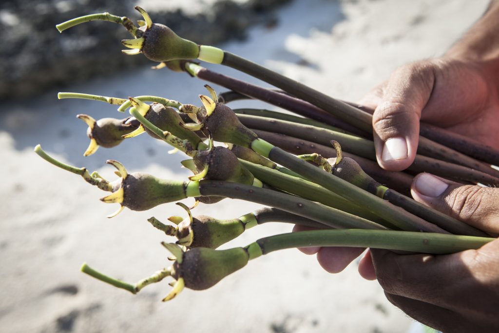
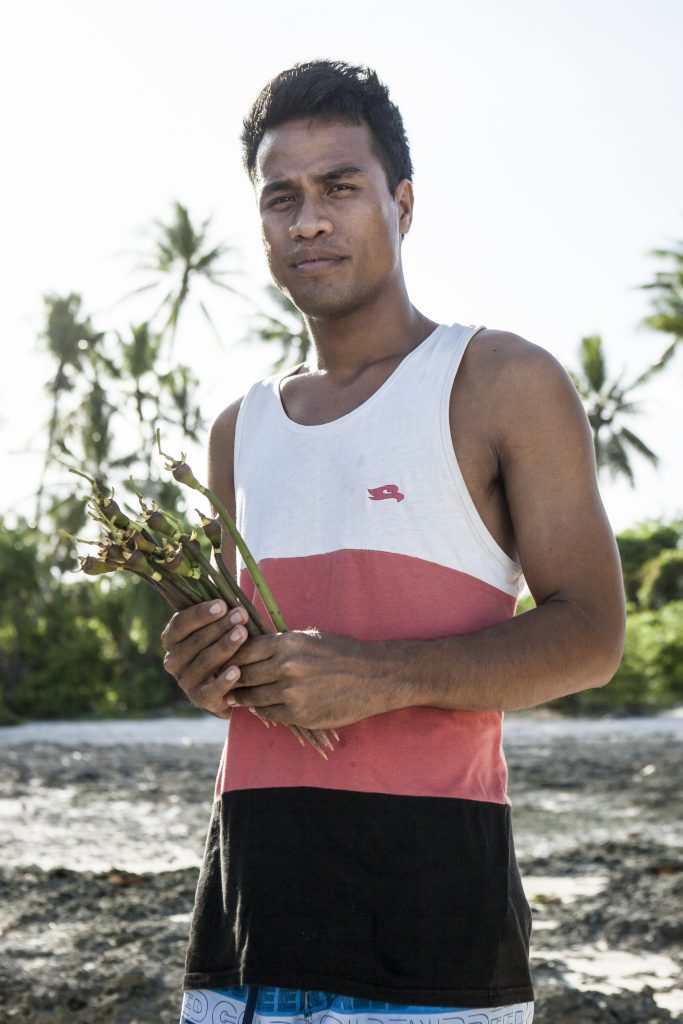
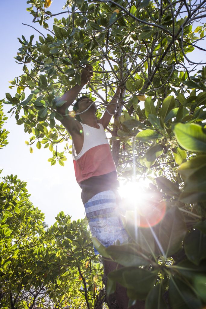
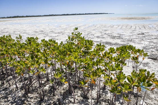
Mangrove planting as coastal protection and adaptation to climate change – a community activity in Ambo, Kiribati

The women that plant mangroves in the Lagoon of South Tarawa, in the village of Ambo, are part of the Kiribati Climate Action Network (KiriCan). They are volunteers. After a long season of planting the saplings in the lagoon, of which only a part will root, the women are having a community party in the Maneba (community house) of Ambo.
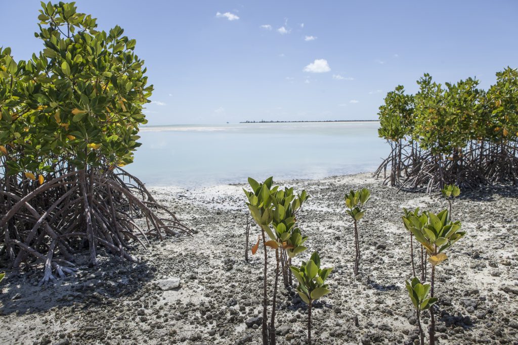
Mangrove planting is an anticipatory adaptation action and a so-called soft coastal protection measure. It is undertaken to buffer coastal environments to reduce the vulnerability of coastal communities from the effects of climate change, including more severe storms and sea-level rise. Compared to hard protection measures, like sea walls, it is often more sustainable and provides employment to the communities. Today mangrovs are threatened by anthropogenic climate change and other human activities. Current and future changes in sea-level, storminess, rain, temperature, atmospheric CO2 concentration, ocean circulation patterns can all mean danger to mangroves. To date, climate change has likely been a smaller threat to mangroves compared to clearing for aquaculture, coastal development and pollution of coastal waters. Based on available evidence, of all the climate change outcomes, sea-level rise may be the greatest threat in the future.
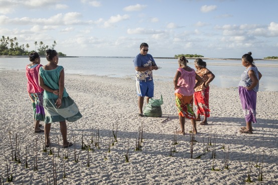
Healthy mangrove forests not only mean coastal protection, but a great benefit also comes from the resources provided by mangrove forests. Mangroves perform valuable regional and site-specific functions. Mangrove loss will reduce coastal water quality, reduce biodiversity, eliminate fish and crustacean nursery habitat, adversely affect adjacent coastal habitat, and eliminate a major resource for human communities that rely on mangroves for numerous products and services. Reduced mangrove coverage and health will increase the threat to human safety and shoreline development from coastal hazards such as erosion, flooding, storm waves and surges, and tsunami, as some scientists have observed following the 2004 Indian Ocean tsunami.
Mangrove ecosystems were able to persist through the quaternary despite substantial disruptions from large sea-level fluctuations, demonstrating that mangroves are highly resilient to change over historic time scales. However, over the coming decades, mangrove vulnerability and responses to climate change will be highly influenced by anthropogenic disturbances. Mangrove cover on Pacific Islands have been reduced substantially in recent years. Adaptation measures like mangrove planting can offset anticipated mangrove losses and improve resistance and resilience to climate change. Coastal planning can adapt to facilitate mangrove migration with sea-level rise. With the replanting of mangroves and trees, it is hoped that South Tarawa, the capital and urban aggregation of Kiribati, will be protected from sea level rise, and king tides, as well as acting as future sources of fuelwood and building construction materials and fish breeding grounds.
Based on texts written by Eric L. Gilman (IUCN, Global Marine Programme, Honolulu, USA) and Alia Levine and Bonnie Flaws (Dev-Zone, Wellington, New Zealand).
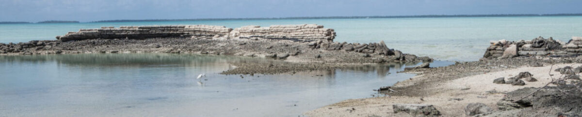
Climate change adaptation gone wrong: The case of sea walls in Kiribati
Islands are recognized as uniquely exposed to climate change, now and in the future. Anthropogenic climate change challenges for island inhabitants include issues of water security, salinization of groundwater, stronger tropical-cyclone impacts and shoreline erosion and coastal flooding due to sea-level rise. Kiribati consists of 32 coral atolls and reef islands, as well as the raised limestone island Banaba. Current studies suggest that two thirds of the land are less than 2 m above mean sea level and maximum elevations are roughly 3 m. Adding to the risks for island communities created by anthropogenic climate change are a multitude of socio-economic vulnerabilities in Small Island Development States, such as Kiribati. These vulnerabilities are linked to the (post)-colonial structures and dependencies that persist, in various forms, until today. Among other factors, colonialism and globalization processes brought a change in lifestyles and a loss of local ecological knowledge and adaptation possibilities Island Style.
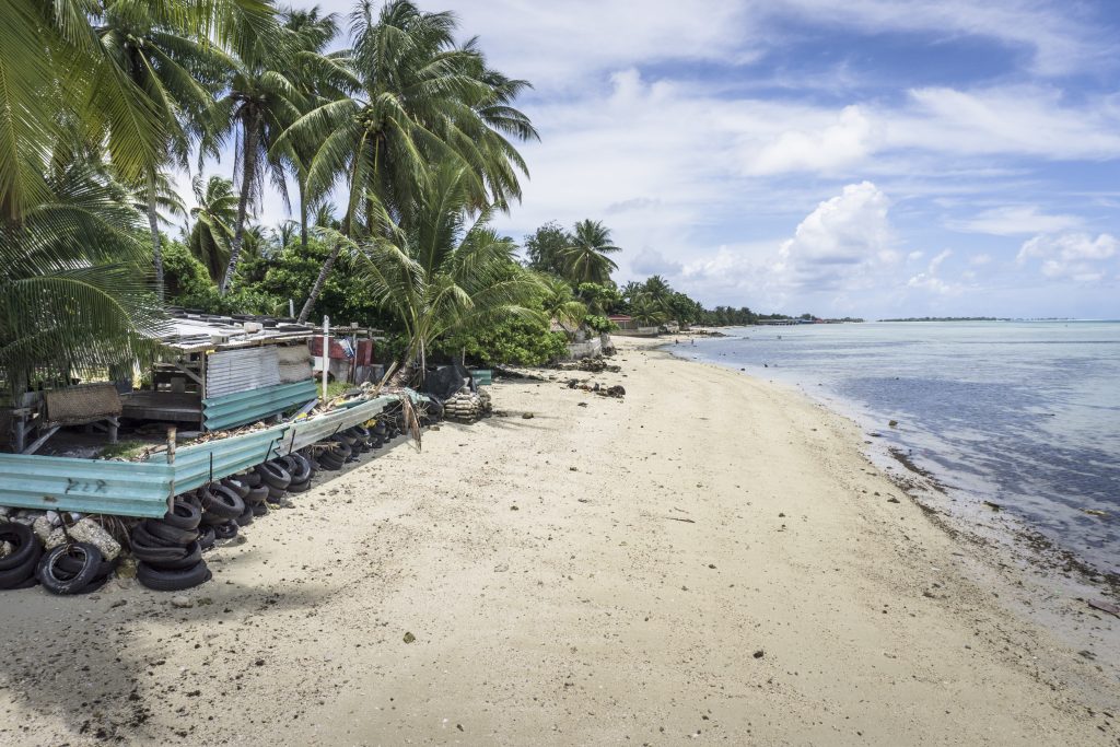
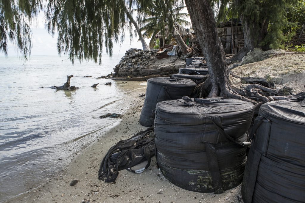
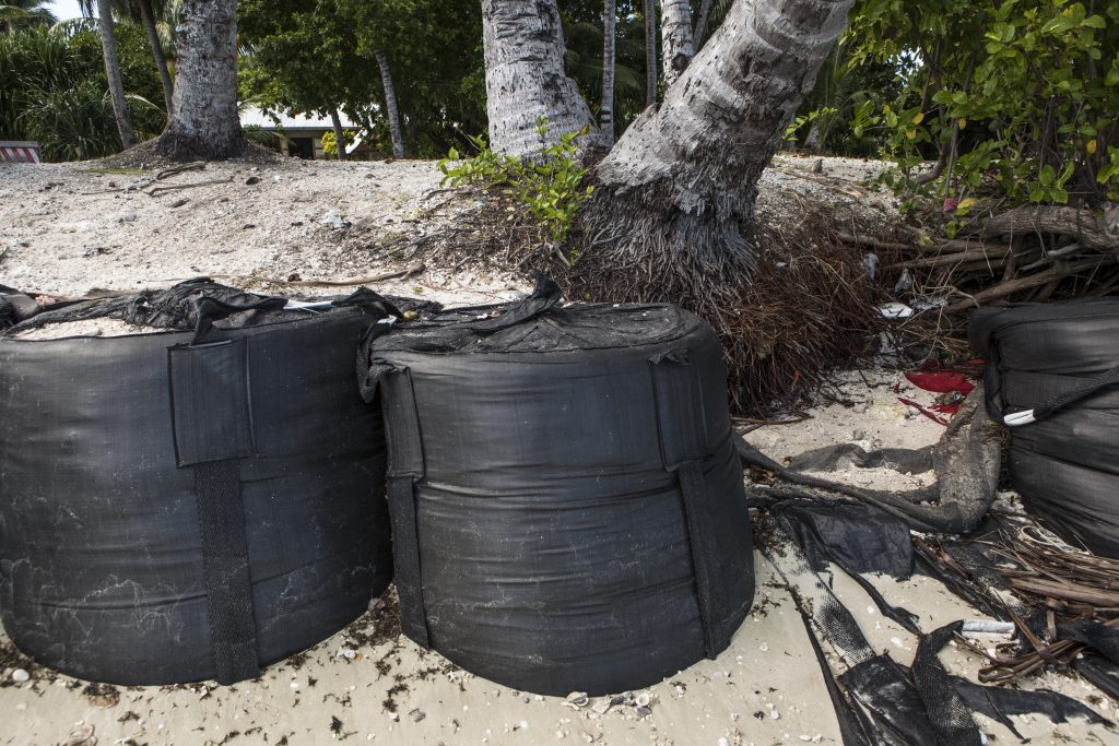
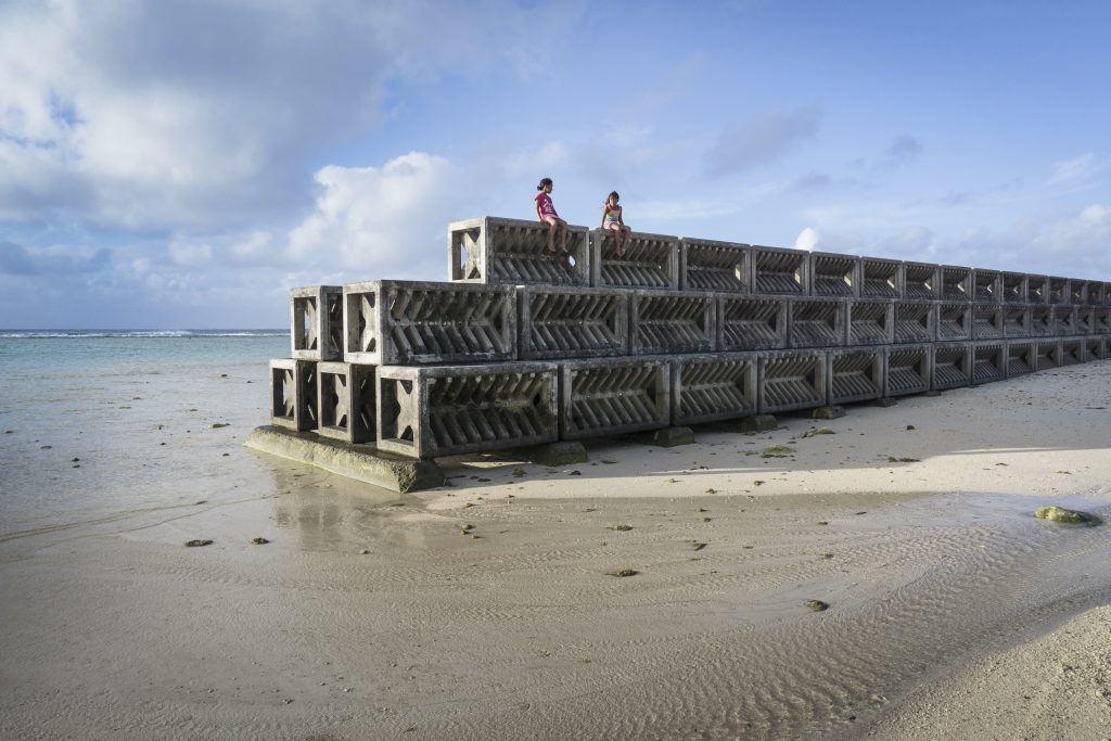
Coastal protection measures can be well suited to immediately protect coastal assets from inundation and protect from land loss during high water events. They can be divided into three categories: hard protection measures, soft measures, and retreat or migration. Hard measures include land reclamation and physical barriers like sea walls. Sea walls in Kiribati are normally built from coral rock, sand bags and concrete blocks. They represent most of the engineered coastal structures in South Tarawa, the capital of Kiribati. Most solutions for climate-change adaptation in Kiribati have been short-term, reflecting a dependence on project based and limited assistance from donor countries and a preference by consultants, engineers and many I-Kiribati for visible, technical solutions. In Kiribati, there is rarely sufficient data to adequately inform the design and positioning of protective structures.
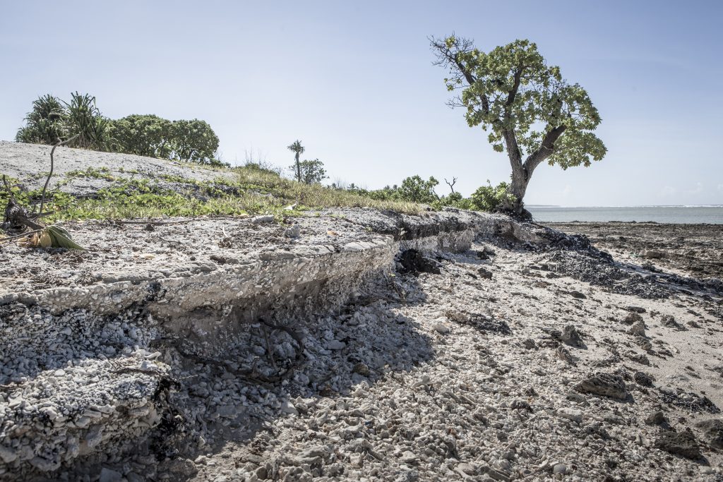
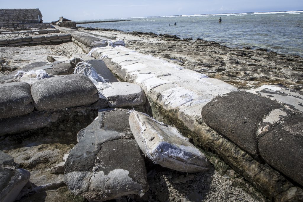
Sea walls that are built in a wrong way, with cheap material and potentially in the wrong location can have disastrous consequences, invariably marked by the degradation of structures like sea walls and irreversible negative impacts. These impacts range from beach narrowing and beach loss to nearshore ecosystem degradation and biodiversity loss, which might also threaten food security for coastal inhabitants. Expensive, hard measures require regular maintenance; which is rarely provided by international cooperation that pays for the structures. There are so many broken, aid-funded sea walls, roads, and water systems in South Tarawa that a report labeled the atoll a „graveyard of shortlived infrastructure investments“.
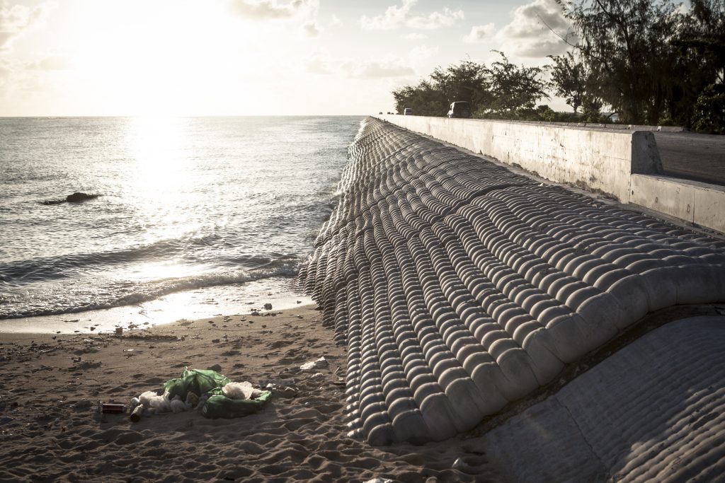
Research shows that traditional knowledge and coping capacity on islands is likely to help people better adapt to future climate change. In addition to localized knowledge, it is important for those on islands involved in environmental governance to be aware of their unique attributes and specific local and regional environmental contexts. And, maybe most important, is to replace the commonly one-way direction of adaptation measures with genuine interaction in which both external agents and target communities have at least equal say in the design and implementation of adaptation pathways.
Based on texts written by Simon Donner (Fraser University, Vancouver, Canada) and Patrick Nunn (University of the Sunshine Coast, Australia).
For further information visit
www.barbaradombrowski.com
www.tropic-ice.com
https://www.marinesocialscience.uni-kiel.de/